Professor Frances Wall, right, at the Tellus South West conference.
‘Big data’ on the natural capital of the South West launched.
Key representatives from the University of Exeter’s Camborne School of Mines (CSM) have helped launch new data that map the geology, natural resources and environment of the South West region.
The project, called Tellus South West, showcased its new data, which provide information on the soils, rocks, landscape and ecology of Devon and Cornwall to an unprecedented depth and level, at a special event held in Plymouth.
More than 100 delegates from a wide variety of sectors, including agriculture, local government, minerals and mining, health and geothermal energy, attended the launch event, where scientists from the British Geological Survey and the Centre for Ecology & Hydrology used 3D displays and maps to demonstrate the data in detail.
The launch focused on the results of two airborne surveys carried out in 2013 - an airborne geophysical survey measuring minute traces of natural magnetism and radioactivity to make maps of the properties of the rocks, soils and fluids under the skin of the Earth; and an airborne LiDAR survey, which bounced a laser beam off the ground and vegetation to make a 3D map of the landscape, buildings and tree cover.
Delegates were also shown some early examples of maps and data about chemistry and microbes in soils and waters, and the status of natural habitats, that will be published this summer.
The project is an initiative of the British Geological Survey (BGS), British Antarctic Survey (BAS), and Centre for Ecology and Hydrology (CEH), working with Camborne School of Mines (CSM) at the University of Exeter.
Professor Frances Wall from CSM, which is part of the University of Exeter’s Penryn Campus, and who attended the meeting said: “We are delighted to be involved in this survey that will help us understand the geology, natural resources and environment of South West England. Our role is to ensure that local researchers, companies, government and other organisations are fully aware of the survey so that they can gain maximum benefit from the results. We are also looking forward to using the data in our own research across the university”
The aim of Tellus South West is to provide scientific data that will be used to benefit the economy, environment, agriculture, land management and health of South West England. It will expand our geological knowledge of the region, contribute to a greater understanding of natural hazards (such as landslides and flooding) and provide a baseline against which future environmental change can be measured. This is especially important in ensuring that the development of mineral resources and urbanisation have minimal impact on the environment.
Professor John Ludden, Chief Executive, British Geological Survey said: “The Tellus South West survey has provided us with a baseline to understand geological and ecosystem evolution in the South West of England. This baseline in rock properties, soil and vegetation will provide essential information for decision making to inform industry and governments in the future.”
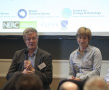
The Tellus South West project was also the subject of a meeting of the All-Party Parliamentary Group on Earth and Environmental Sciences, chaired by Martin Caton MP and convened by Cally Oldershaw, on 13 May. Professor Wall attended to help answer questions in the discussion session.
Date: 27 May 2014